SECOND WAIKATO RIVER BRIDGE FOR TAUPō TOWNSHIP NOW URGENT
The Taupō District Council is to begin detailed planning on a second bridge across the Waikato River, with construction possible in 2029/30 - three years earlier than anticipated.
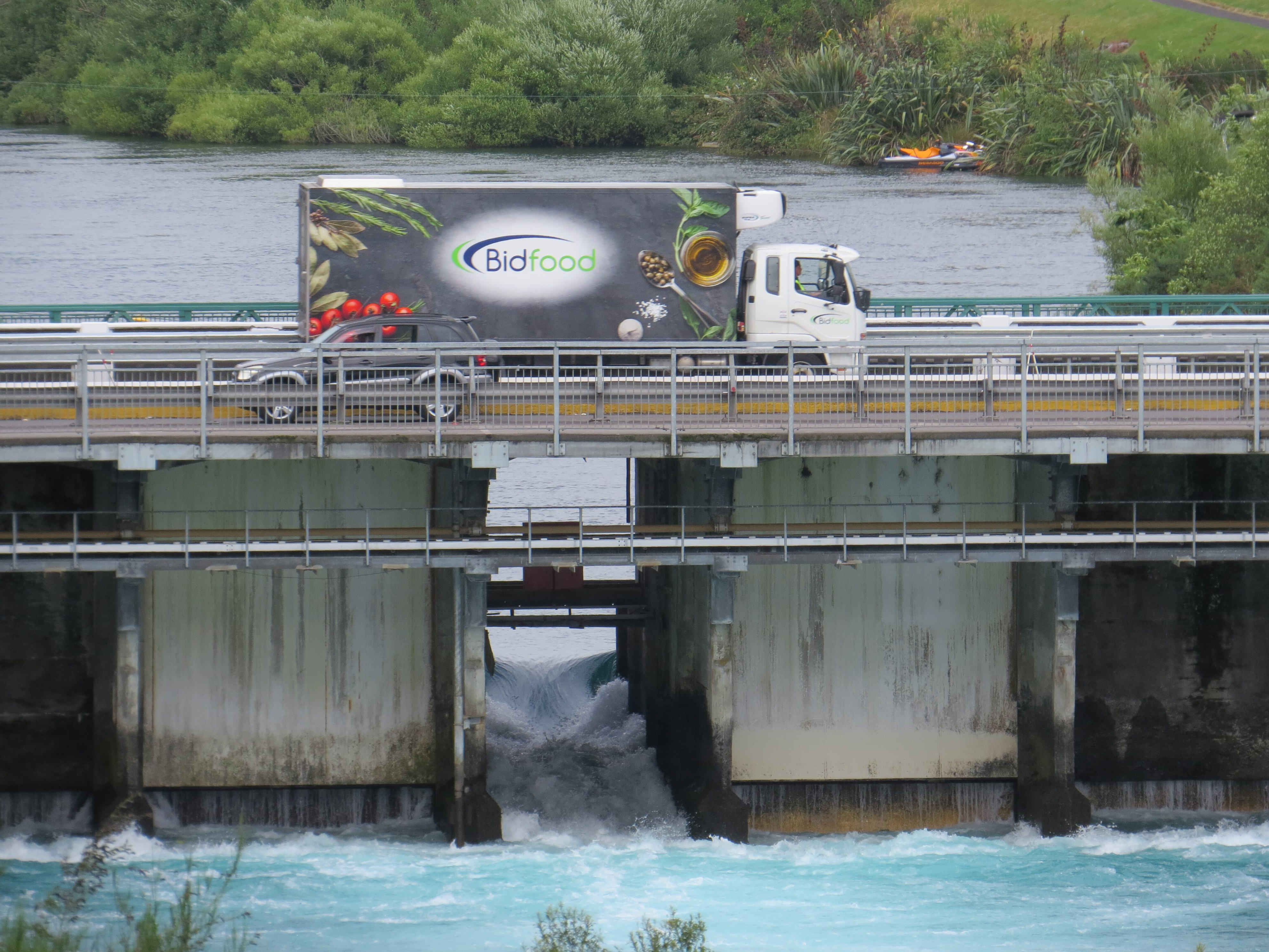
The existing Control Gates Bridge is close to “saturation” point, according to a report in the council’s 2024-2034 Long Term Plan Infrastructure Strategy. A new bridge had a rough-estimate cost of $73.5 million, or $163 a year for every ratepayer in the district.
Deputy Mayor Kevin Taylor said any solution would be dependent on what power generation company Mercury - owners of the Control Gates Bridge - planned to do, what level of infrastructure the public wanted and were prepared to pay for and the ability to source funding from central government.
The route ceased to be part of the state highway network after the East Taupō Arterial route opened in 2010, so was not fully funded by NZTA - Waka Kotahi.
The existing bridge serves a dual purpose as the control gates for the lake outlet, in relation to hydro-electric dams further down the river, however with only two lanes, it is now the main bottleneck for road traffic between northern and southern suburbs. Adding extra lanes to the existing bridge is not an option.
Taylor said all of the options were on the table and work would be done over the next three years to firm up where the bridge would go, consultation with the local hapū, the design, cost and funding sources, before the public was given another chance to have its say in the 2027-2037 LTP.
He said there were scales of service and they could build infrastructure that dealt easily with full peak capacity at “enormous cost, that sits idle most of the time” or they could build something more modest that meets the need most of the time at a lesser cost.
During the last long-term plan - in 2021 - it was thought the bridge would not be required until 2033, the infrastructure strategy states.
“Since 2021, Taupō has experienced significant growth. Much earlier than anticipated, traffic volumes have already reached the level when a new bridge and supporting works were expected to be needed. This means that the current two-lane Control Gates Bridge is already at capacity and performance already reaching service levels E and close to F at peak times,” the strategy reads.
Service level F is described as “the free flow speed of a corridor reaching 100% of saturation flow or greater with potential for complete failure of the network to operate”.
“Resolution of this issue is required to allow continued growth in North Taupō.”
Land has been recently rezoned in Nukuhau to allow for an extra 780 houses but permission has only been granted for 140 of those houses until the bridge problem was sorted out.
There was still no certainty over where the bridge would emerge on the southern side of the river, with options that range from the existing route through to the Spa Rd roundabout, or a bridge further downstream that connects more directly with the new by-pass route through town, possibly down Opepe St and Titiraupenga St.
Taylor said no decisions had been made and there was no preferred location for the bridge at this stage. That work would be done over the next three years.
Planners also reiterated the project was still in the very early stage.
“We are not pre-determining the solution in this Long-term Plan (2024). In the next Long-term Plan (2027) we hope to be able to confirm with some certainty the expected cost, location, and design of the bridge and associated intersection and network improvements,” the strategy reads.
Work between now and 2027
- Geotechnical assessment.
- Detailed design and costings.
- Discussions with consenting authorities.
- Discussions with Mercury (landowners and the current owners of the Control Gates Bridge).
- Discussions with the NZ Transport Agency and Central Government over funding support.
“We will also work with iwi and hapū on design options and their impacts to recognise their long-standing relationships with the waters that flow from Taupō Moana through the upper Waikato Awa and their deep interest in infrastructure planning for the existing and any new bridge,” the strategy states.
The strategy also found no viable alternatives to adding extra lanes across the river.
Rejected options
- Expand the current bridge: The current bridge is not suitable to expand to provide additional lanes, meaning a second bridge structure is required.
- Stop growth: We cannot stop growth. Limiting the number of houses built will only exacerbate housing shortages, affordability and overcrowding. We also have obligations under the National Policy Statement on Urban Development to provide the infrastructure required to support zoned residential land, and land identified in our growth strategy in north Taupō.
- Don’t do it: If we don’t do it the problem will only get worse, growth will be prevented, and we won’t be meeting our obligations under the National Policy Statement on Urban Development. While the time delay is currently relatively small and predictable, the stability of traffic flows is becoming at risk – meaning that delays may become unpredictably severe on some days.
- Demand management: We do not have any tools to stop people driving (when that’s what they prefer). Tolls and/or congestion charging is not currently permitted by legislation on existing roads and may only be considered for larger cities. The size of the charge needed to shift behaviour, and the administration costs of managing such a charging system in Taupō are likely to also be significant barriers.
- Providing better buses, and walking and cycling connections: There are already reasonable walking and cycling options. We have recently made safety improvements to the crossing of Wairakei Drive, and there are good connections to Taupō-nui-a-Tia College. We have also improved walking and cycling access and crossing options into Taupō town along Tongariro St. Despite these options being available, walking and cycling are not popular enough to reduce traffic problems. A new bridge will also aim to achieve improved walking and cycling connections, especially for commuters and school students in northern Taupō suburbs.
- Improving current road layout and making smaller improvements: We have recently made improvements to the Norman Smith / Wairakei Drive intersection, and Spa Road / Tongariro roundabout. The main bottleneck is now the bridge itself.
- Traffic management initiatives including promoting use of alternative entrances: We will continue to do this for summer and holiday peaks and events, however this won’t affect local daily traffic, which is by itself pushing the limits of the current two-lane bridge at morning and evening peak times.